
GIS
Geographic Information Systems (GIS) are tools and technologies used to capture, store, analyze, and visualize spatial (location-based) data.
In health systems, GIS helps answer critical questions like:
- Where are diseases occurring?
- Which populations are underserved?
- How accessible are health facilities?
GIS transforms raw data into maps and spatial insights for better decision-making.
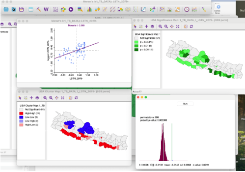
Why GIS Matters in Health
Health data is not just numbers — it has location.
GIS enables:
- Disease surveillance and outbreak tracking
- Health facility mapping and planning
- Emergency response optimization
- Equity analysis (who is being left behind)
Key Components of GIS
1. Spatial Data
Location-based data such as:
- Coordinates (latitude, longitude)
- Administrative boundaries
- Facility locations
2. Attribute Data
Descriptive data linked to locations:
- Population
- Disease cases
- Service coverage
3. Mapping & Visualization
- Thematic maps
- Heatmaps
- Choropleth maps
4. Spatial Analysis
GIS allows advanced analysis like:
- Distance and travel time
- Clustering of disease cases
- Coverage gaps
Common GIS Tools
- QGIS – Free and widely used
- ArcGIS – Enterprise GIS solution
- Google Earth Engine – Cloud-based analysis
GIS in Digital Health Systems
- Map-based dashboards
- Facility geolocation
- Layered data visualization
- Choropleth maps by district/region
Use Cases in Health
Disease Surveillance
- Track outbreaks (e.g., malaria, dengue)
- Identify hotspots
Health Service Planning
- Optimize facility placement
- Analyze service coverage
Immunization Programs
- Map vaccination coverage
- Identify zero-dose children areas
Emergency Response
- Disaster mapping
- Resource allocation
GIS Data Layers in Health
Typical layers include:
- Administrative boundaries
- Health facilities
- Population density
- Disease incidence
- Infrastructure (roads, rivers)